4 expert tips on how to win prizes with your drone photography
The first edition of the Aerial Photography Awards – which took place on the 15th of October, 2020 – got overwhelmed with thousands of submissions, after which the Belgian content creators emerged as the big winners with a whopping ten awarded entries.
We had the opportunity to talk with one of these Belgian awards winners: Reginald Van de Velde. We asked him about the contest, his winning pictures, and his recommendations for starting photographers.
Page Contents
About the Aerial Photography Awards
With thousands of submissions from 65 countries, the quality of photos submitted for the first-ever edition of the Aerial Photography Awards exceeded all expectations. The competition – which originated in Paris and was founded by Christophe Martin – celebrates excellence in aerial photography.
The most popular categories during the contest were Abstract, Architecture, Constructions, Daily life, Landscapes, Sports, Travel, and Wildlife. In order to select the winning photographers for each of these categories, the jury voted for their favorite pictures and combined the scores to select the final winner.
Another remarkable fact about this competition: Belgium was the top winning country with a whopping ten winners. This is an immense achievement for a small country which has very restrictive drone regulations.
One of these Belgian photographers is Reginald Van de Velde, who was voted as Aerial Photographer of the Year in the Editorial category.
About Reginald Van de Velde
Reginald Van de Velde, born in Belgium, is known as a wanderer of wastelands who scouts the unknown and the unseen, trying to capture the world’s lost beauty.
Over the past few years, his work has been exhibited internationally in both solo and group expos and he was awarded many times: from winning at the Cannes Lions Festival to getting publications in National Geographic.
After winning the Editorial category, Reginald mentioned how honored he felt winning this award: “ I’m incredibly humbled: there’s so much competition out there with so many great and inspiring photographers. Aerial photography has taken such a big leap in the past few years – the creative output and pace are simply mind-blowing! Glad to be part of this journey.”
Reginald’s winning shots
Wondering what pictures Reginald submitted to the Aerial Photography Awards, in order to win the title of Aerial Photographer of the Year in the Editorial category? We’ve listed them below!
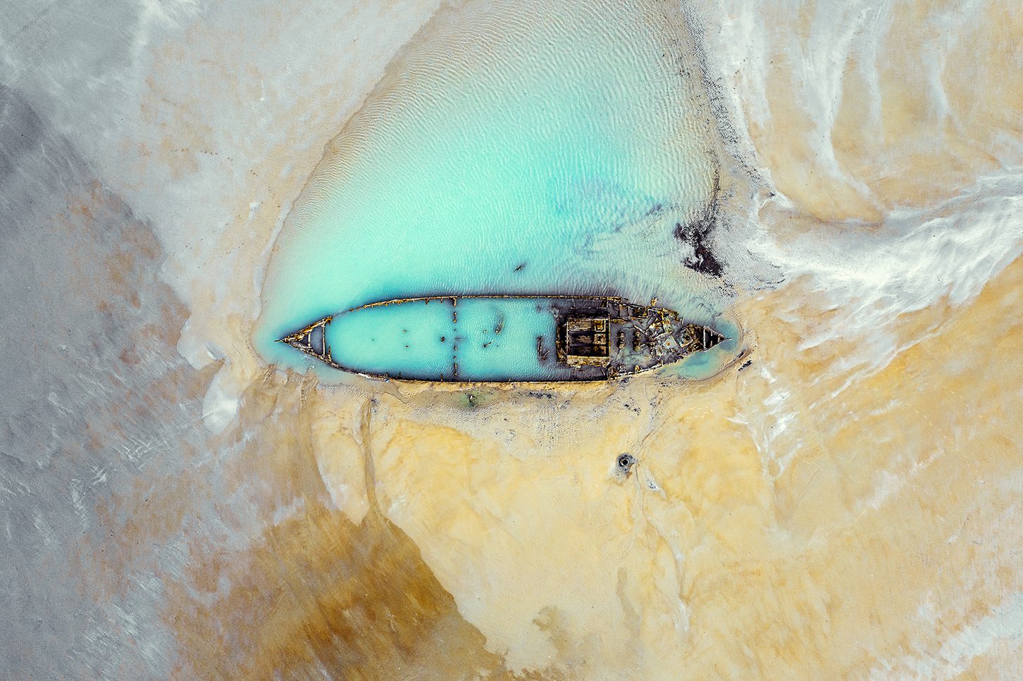
British WW1 minesweeper – Abandoned places (1st place)
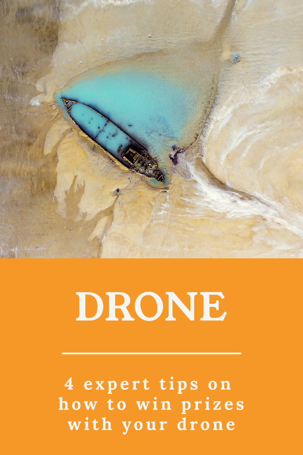
This picture shows the wreck of a British WW1 minesweeper which ran aground the French coast and got buried under the sand for many years, only becoming visible in recent years due to the rapid decline of the coastal line caused by marine erosion.
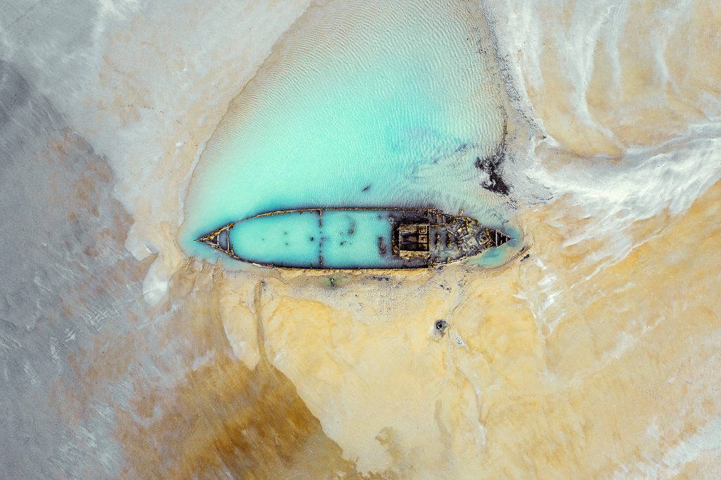
Reginald Van de Velde even made a short cinematic video of the British minesweeper in France, which can be watched below.
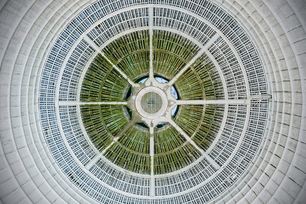
Abandoned cooling tower – Abandoned places (4th place)
Reginald’s second shot in the category “abandoned places” is a picture of an abandoned cooling tower in Belgium. The cooling tower was meant to remove excessive heat from power plants and – in the center of this photo – you can see the inlet of water that would be distributed to canals which cool down the plant.
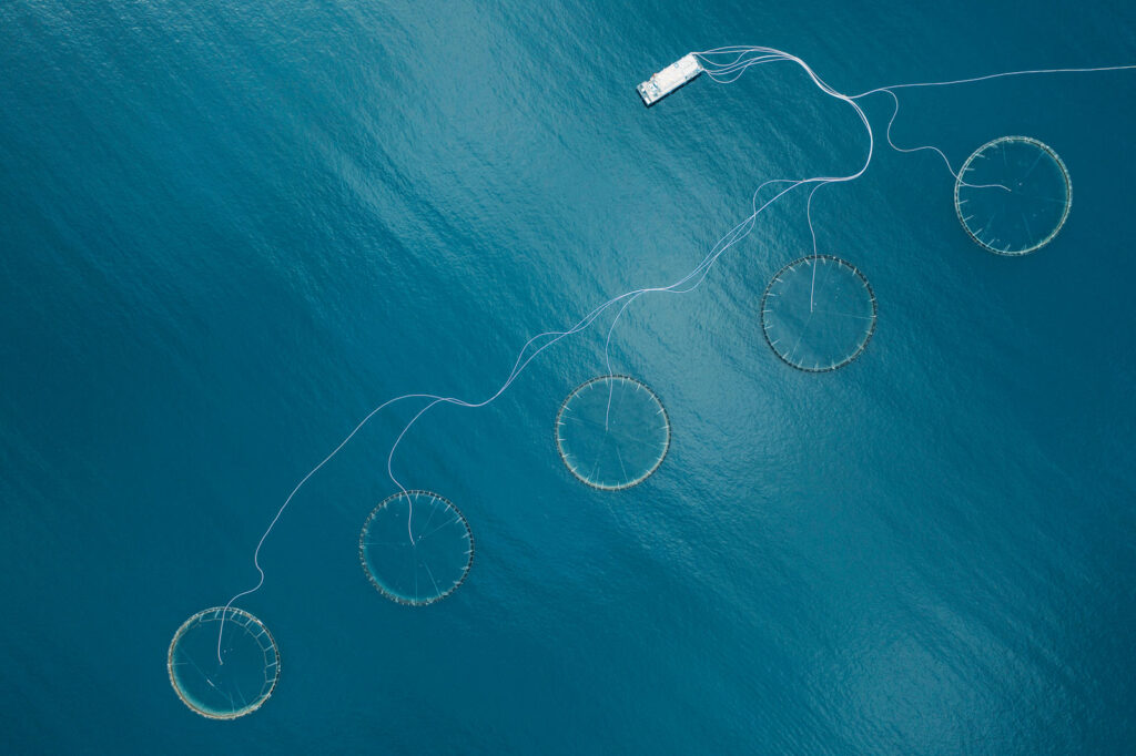
Norwegian fjords – (Industrial – 3rd place)
Located in the majestic Norwegian fjords, aquacultures – or fish farms – are a common sight. These aquacultures are Huge nets which are floating on the cold crystal-clear ocean waters. They are used as a method to breed salmon for consumption.
Norway is the world leader in fish farming and it produces and exports salmon to more than 140 countries. Seeing these nets from the sky creates a very beautiful and abstract view.
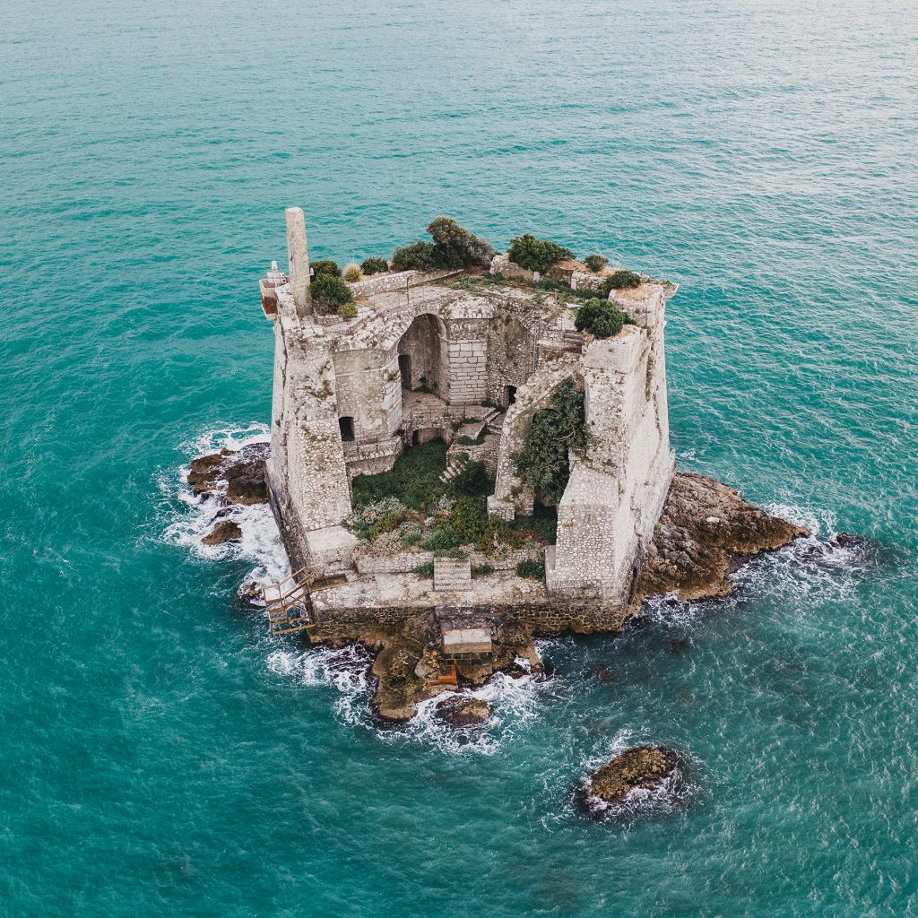
Special Mention – 17th-century defense fort
Not awarded but selected for a special mention, is the picture of these Italian 17th-century ruins which used to be a defense fortification. This fort suffered severely from gunfire between the British army and the Napoleon fleet.
The fort was almost demolished until the Italian navy saw its potential and used it as a target during shooting practices. In the eighties this historical gem finally got protected, reminding us of a vivid and brutal past.
Reginald’s tips for drone photography
Aerial photography might seem like black magic for some of our adventurous readers and aspiring photographers, that’s why we decided to Reginald Van de Velde for some tips and technical details behind his shots.
Finding new spots
An important aspect of creating great pictures is finding the right spots to photograph. When asked, Reginald was kind enough to tell us how he found these award-winning locations: “Honestly? It’s the question I get most often; where I get my inspiration and how I find new spots. Well…
Back in the days I used Google’s Panoramio as a photo secret vault. This geo-location-based photo sharing community proved to be incredibly useful, especially for ruins and locations off the beaten path. People from all over the world would drop a sphere or photo and you could just hop from one spot to the other. It was incredibly popular with the Russian community, serving me well for my research in the greater Caucasus area. Unfortunately, Google pulled the plug on this service. Spheres appear in Google Maps now too, but these are only recent additions. Panoramio was a work of more than a decade. Nowadays I rely on Instagram mostly, scouting photos based on location.
For the very obscure and hard to find spots I still rely on traditional internet blogs and older articles after which I try to pinpoint the location myself. For this approach, I have two pro tips:
- Always set Google in the language of your destination. You’ll be amazed at how different the results are.
- Have your VPN reroute you to the country of destination and access Google in this way. Again, a completely different scenario of results is presented.
With this approach, you circumvent Google’s filter bubble, and get results you would otherwise have missed.”
Keeping track of (local) drone regulations
Finding the locations is one thing, but being allowed to hover over a landmark with a drone is another. That’s why it’s important to check the local regulations before you start planning your trip!
“First and foremost I check DJI’s Fly Safe Geozone map and check the destination where I would like to fly with my drone. I mainly go to abandoned and remote places, so I rarely bump into any restrictions or obstacles.
With every new trip I make, I also check the specific rules and regulations per country listed on UAV Coach. It’s mind-blowing to see how diverse and different each country is, I’m so looking forward to the new EU drone regulations taking effect 1st of January 2021. A new (and less strict) era for aerial!”
Get to know your drone
For new drone pilots, Reginald has one important tip: get to know your drone before you go on an adventure!
“It’s very important to be aware of the latency of your drone. If you want to slow down on the remote, the drone won’t slow down as abrupt. You have to remember: a drone is a big and heavy mass, and it takes quite some time to come to a full stop when it’s in acceleration – The more flights you’ll do, the more comfortable you’ll get. So if you’re doing technical flights close to objects/buildings/trees you need to be aware of this!
For the very technical shots, I always turn off all visionary sensors and fly full manually. This allows me to get extremely close to objects, dunes, doing fly-throughs, indoor flights, flying low over still water and through mist and fog. You need to be 100% aware of the whereabouts of yourself, your drone and the environment your drone is flying in, so pre-check the area visually before any flight and check for any cables, high voltage wires or obstructions.
Another very important thing to keep in mind is weather conditions. It can be totally windstill on a mountain slope where you are standing, but once your drone is airborne and moving over a ledge it could be knocked out by a strong wind.
Temperature is another crucial aspect. If you’re planning on doing mountain hikes in the Dolomites, Norway or Iceland, you’ll need to be aware of the very cold and freezing layers above you. It will drain your battery significantly, to the point the “safe to return to home”-function drops in an instant and your drone will land immediately. High altitude and cold flights usually means you have to calculate extra buffer time to land your drone.“
Work with good equipment
A professional needs good equipment, so we were wondering what the drone setup of an award-winning photographer looks like.
“I have the DJI Mavic 2 Pro and use it in combination with the Polar Pro filters. The drone itself has a Hasselblad camera and a 20 MP sensor, resulting in beautiful high-res photos and very sharp and stable 4K footage.
The batteries on the DJI Mavic 2 Pro give me a very decent flight time as well and I never lost connection with the remote. Size-wise it fits perfectly in my camera backpack, allowing me to take my drone on big hikes as well. It’s definitely a huge asset, having this drone.”

