Discover the Best Hiking Trails in Austin
When exploring the great outdoors in Austin, there are many hiking trails to choose from. From rugged and hilly terrain to scenic overlooks with great views of the surrounding area, Austin has a variety of trails that offer something for everyone.
In this blog post, we’ll take a look at some of the best hiking trails in Austin, including popular destinations like the Barton Creek Greenbelt and McKinney Falls State Park. Whether you’re a seasoned hiker or just looking to take a leisurely stroll, there’s a trail in Austin that’s sure to suit your needs.
Page Contents
The hiking culture in Austin
Austin has a vibrant and active outdoor culture, with many residents enjoying the area’s natural beauty through activities such as hiking, biking, and camping. The city is home to a number of popular outdoor destinations, including the Barton Creek Greenbelt, Wild Basin Preserve, and McKinney Falls State Park, which offer a range of hiking trails for people of all skill levels.
Additionally, many outdoor clubs and groups in the area organize regular hikes and other outdoor events, providing a great opportunity for people to get involved in the local hiking community. Overall, Austin is a great place for people who love the outdoors, and the city has a strong culture of outdoor recreation.
The Best Hiking Trails in Austin
Whether you’re a seasoned hiker or a beginner, Austin has a trail that’s right for you. In this blog post, we’ll take a deeper look at the best hiking trails in Austin;
- Barton Creek Greenbelt
- Wild Basin Preserve
- McKinney Falls State Park
- St. Edward’s Park
- Mount Bonnell
Please keep in mind that Austin is generally flat, with an average elevation of just over 400 feet above sea level. The highest point in Austin is Mount Bonnell, which only stands at an elevation of 785 feet above sea level. If you are an experienced hiker and are looking for more challenging trails, you may want to consider trying some trails outside of Austin or attempting to reach the highest point in each US state, also known as highpointing the USA.
When to visit these hiking trails in Austin?
The best time to visit these hiking trails will depend on your personal preferences and the activities you want to do.
Summer can be an interesting time to visit the hiking trails in Austin because the weather is warm and there are many opportunities to enjoy outdoor activities such as swimming and rock climbing. However, it can also be very hot and humid during the summer, so it is important to bring plenty of water and take breaks in the shade to avoid heat exhaustion.
Winter can also be a nice time to visit the hiking trails in Austin, as the weather is cooler and there are often fewer crowds. However, it can also be chilly and wet in Austin during the winter, so it is important to dress appropriately and be prepared for the weather. Winter is also a good time for birdwatching, as many species of birds can be seen in the area during this time of year.
What to do at these hiking trails in Austin?
Depending on your interests and the specific trails you visit, there are many things to do at the Austin hiking trails. Some common activities include hiking, rock climbing, mountain biking, and birdwatching. The trails in Austin offer a variety of terrain, including hills, rocky sections, and wooded areas, and they are home to a wide range of plant and animal life. Many trails also offer great views of the surrounding area and several scenic overlooks along the way.
In addition to the activities available on the trails themselves, there are also many other things to do in the surrounding area. Austin is a vibrant city with a thriving arts and culture scene, and there are many restaurants, shops, and other attractions to explore. Some popular nearby attractions include the Barton Springs Pool, the Zilker Botanical Garden, and the Lady Bird Lake Hike and Bike Trail.
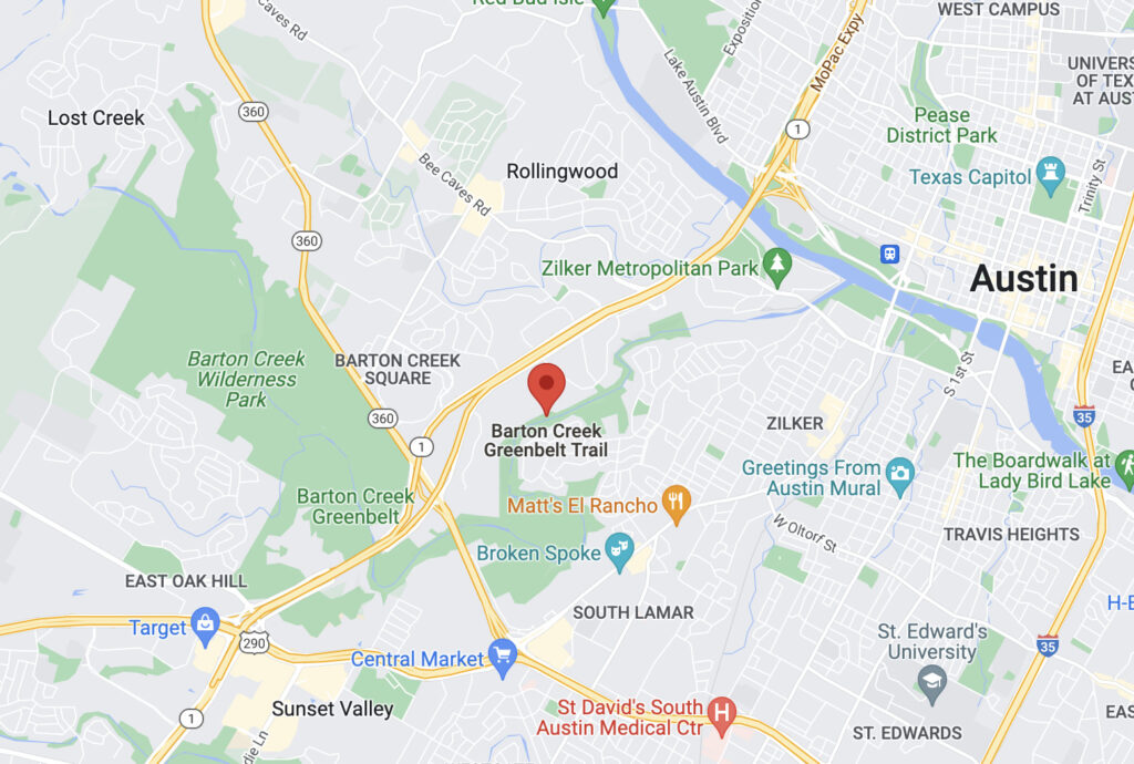
Hiking in Barton Creek Greenbelt
The Barton Creek Greenbelt is a special place in Austin, as it is located in the heart of the city and consists of a network of trails that wind through the hills and valleys of the Barton Creek watershed.
The area also has a long history, as it played an important role in the city’s development; Native Americans originally settled it, and later it was used by European settlers for ranching and farming. In the 20th century, the Greenbelt became a popular destination for outdoor recreation, and it has continued to be an important part of the city’s culture and identity.
Today, the Greenbelt is a popular destination for hikers, rock climbers, mountain bikers, and swimmers, and it is an important part of Austin’s outdoor recreation scene.
Basic facts about Barton Creek Greenbelt hiking trail
- Length: The network of trails totals approximately 12 miles.
- Difficulty: The trails range in difficulty from easy to moderate
- Terrain: The trails offer a variety of terrain, including hills, creek crossings, and rocky sections.
- Amenities: The Greenbelt has several trailheads with parking, restrooms, and water fountains.
- Access: The Greenbelt is open to the public and is free to use. It is open from dawn until dusk and avoiding the trails during or after heavy rain is recommended.
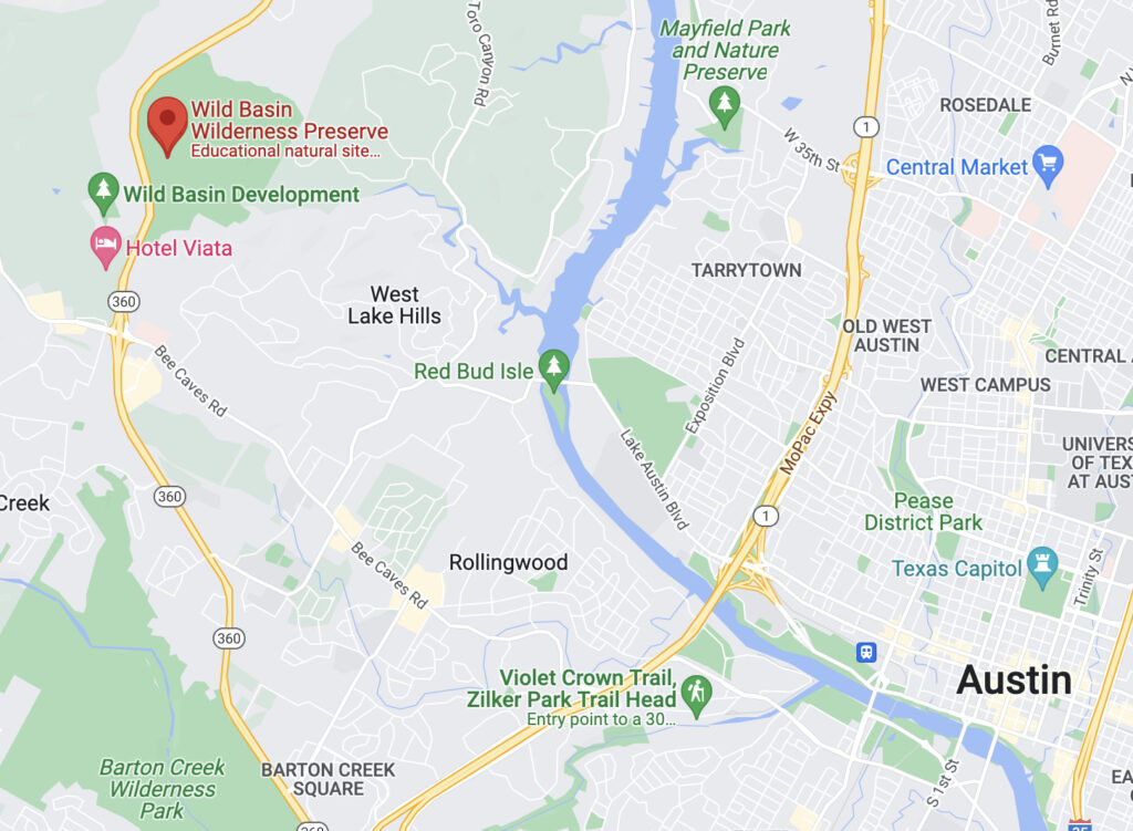
Hiking in Wild Basin Preserve
The Wild Basin Preserve was founded in 1974 by seven women who were members of an environmentalist group called Now or Never, and it was Austin’s first nature preserve. It is most known because of its beautiful natural surroundings and various recreational activities. Located just outside of Austin, the preserve is home to a network of trails that wind through rugged terrain and offer the opportunity to experience the beauty of the preserve.
Today, the Wild Basin Preserve is a popular destination for hikers, birdwatchers, and nature enthusiasts, and it is an important part of the Hill Country’s natural heritage.
Basic facts about Wild Basin Preserve hiking trail
- Length: The preserve has a trail network of approximately 2.5 miles.
- Difficulty: The trails range in difficulty from easy to moderate.
- Terrain: The trails offer a variety of terrain, including hills, rocky sections, and wooded areas.
- Amenities: The preserve has a visitor center with restrooms, a drinking fountain, and several trailheads with parking.
- Access: The Wild Basin Preserve is open to the public and is free to use. It is open from dawn until dusk, and avoiding the trails during or after heavy rain is recommended.
Hiking in McKinney Falls State Park
The McKinney Falls State Park was initially opened on April 1976 by Thomas F. McKinney, a businessman and racehorse breeder who owned and lived on the land until his death in the mid-to-late 19th century.
Anna McKinney, the wife of McKinney, sold small plots of land to family members. In 1885, she sold most of the remaining land to the Smith family. In 1971, J.E. “Pete” Smith gifted 682 acres of the ranch to the state of Texas to be turned into a park.
The park is home to a network of trails that wind through rugged, hilly terrain and offer the opportunity to experience the beauty of the Hill Country.
Basic facts about McKinney Falls State Park hiking trail
- Length: The park has a trail network of approximately 8 miles.
- Difficulty: The trails range in difficulty from easy to moderate.
- Terrain: The trails offer a variety of terrain, including hills, rocky sections, and wooded areas.
- Amenities: The park has a visitor center with restrooms, a drinking fountain, and several trailheads with parking.
- Things to see: The park is also home to two waterfalls, Upper McKinney Falls and Lower McKinney Falls.
- Access: McKinney Falls State Park is open to the public and has an entrance fee. It is open from 8:00 AM until 10:00 PM, and avoiding the trails during or after heavy rain is recommended.

Hiking in St. Edward’s Park
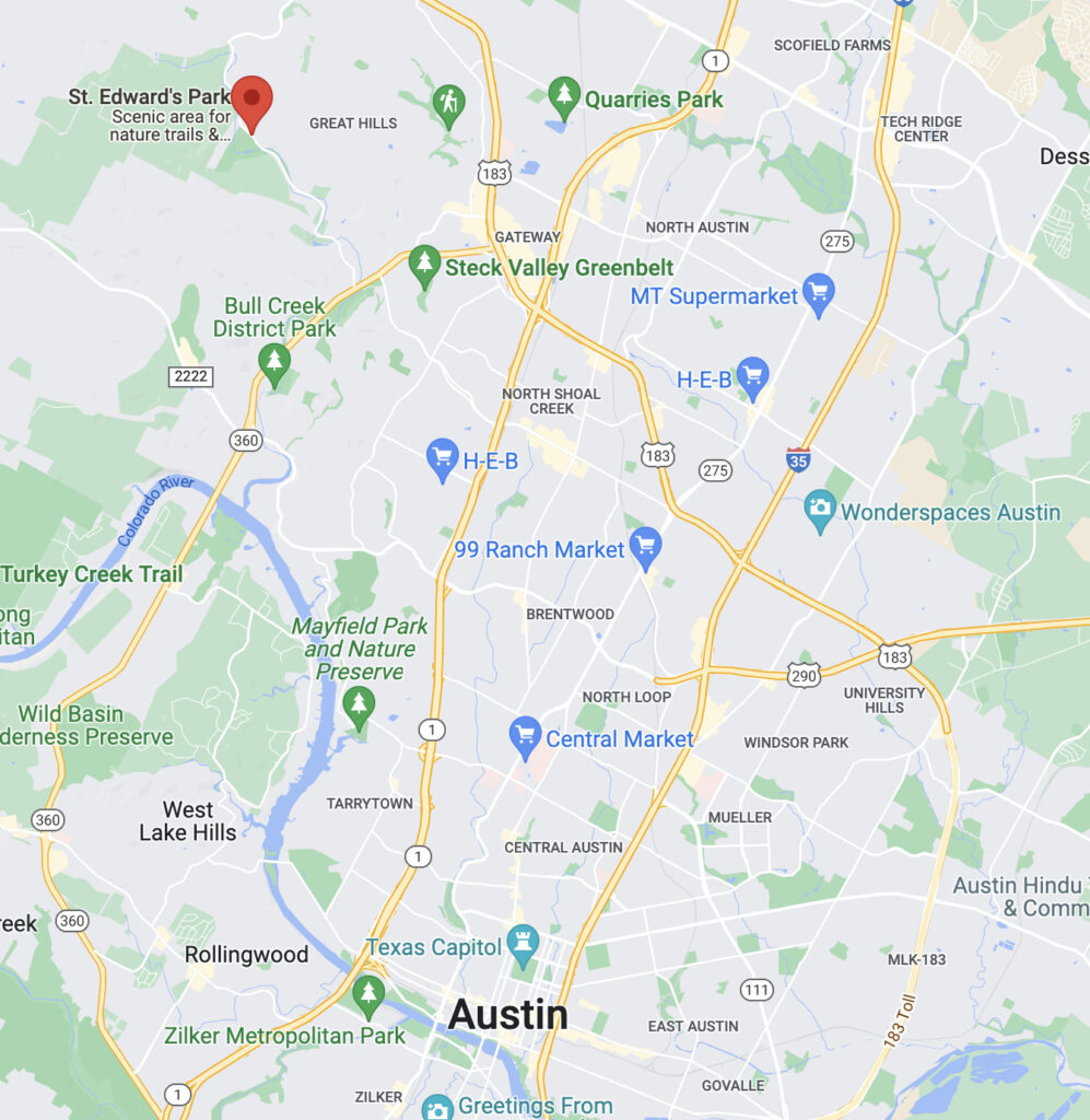
St. Edward’s Park is home to a trail network of approximately 5 miles that wind through hilly terrain. The Park is not too well known, even among long-time Austin residents as it’s hidden away on old Spicewood Springs Road.
There are two hiking trails in St. Edwards Park: the Creek Trail and the Hill Trail.
- The Creek Trail follows Bull Creek for a mile and is relatively easy, with several areas where hikers can view or wade in the creek.
- The Hill Trail is more challenging, as it crosses Bull Creek and climbs to the highest point in the park.
Basic facts about St. Edward’s Park hiking trail
- Length: The park has a trail network of approximately 5 miles.
- Difficulty: The trails range in difficulty from easy to moderate.
- Terrain: The trails offer a variety of terrain, including hills, rocky sections, and wooded areas.
- Amenities: The park has a visitor center with restrooms, a drinking fountain, and several trailheads with parking.
- Access: St. Edward’s Park is open to the public and has an entrance fee. It is open from 8:00 AM until 10:00 PM, and avoiding the trails during or after heavy rain is recommended.
Hiking in Mount Bonnell
Mount Bonnell, also known as Covert Park, is a tourist attraction along the Lake Austin section of the Colorado River. The mount, which was named after George Bonnell (the first commissioner of Indian Affairs in the Republic of Texas), has a rich history dating back to the 1850s when it was a popular tourist destination.
The mount was initially known as Antoinette’s Leap, after a woman who is said to have jumped off the mount to avoid being captured by Native Americans. In the 1930s, the mount was renamed to its current name, Mount Bonnell. It has since been a popular spot for sightseeing, picnics, and other outdoor activities.
Basic facts about Mount Bonnell hiking trail
- Length: The mountain has a trail network of approximately 1 mile.
- Difficulty: The trails range in difficulty from easy to moderate.
- Terrain: The trails offer a variety of terrain, including hills and rocky sections.
- Amenities: The mountain has a parking area at the base and several benches and picnic tables along the trails.
- Things to see: Mount Bonnell is home to a wide range of plant and animal life, and the trails offer the opportunity to see a variety of flora and fauna, including wildflowers, birds, and other wildlife. The mountain is also home to several scenic overlooks, which offer great views of the surrounding area.
- Access: Mount Bonnell is open to the public and is free to use. It is open from dawn until dusk, and avoiding the trails during or after heavy rain is recommended.

Save for later …


